Where the Cotswolds Stop
The edge of the Cotswolds is not a county boundary or a planning line — it is written in the rock underfoot, and it shows in the walls.
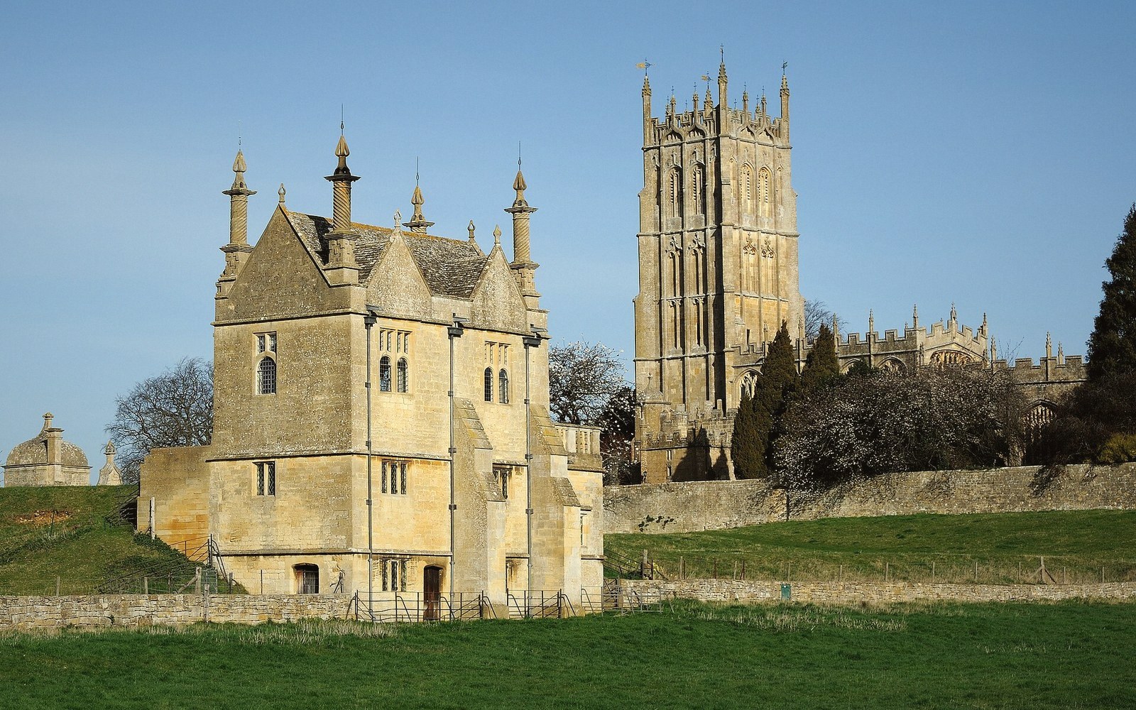
A Line Drawn Underground
Ask most people where the Cotswolds end and they will gesture vaguely east and north, somewhere beyond Chipping Norton or Burford, and call it done. The honest answer is that the Cotswolds end where the oolite does — where the pale, honey-coloured limestone that defines the whole plateau gives way to a different stone entirely. That boundary runs through north Oxfordshire with surprising abruptness, and once you know what to look for, you can place yourself within a mile or two simply by looking at the walls.
The Cotswold oolite is a Jurassic limestone, laid down in warm, shallow seas roughly 165 million years ago. Its name describes its texture: oolite comes from the Greek for egg-stone, and under a lens the rock resolves into tiny spherical grains, each one the fossilised remnant of a calcium-coated particle that rolled in ancient surf. Quarried and dressed, it produces the cream-to-amber building stone that Bourton-on-the-Water, Burford and the Cotswold villages have made world-famous. It cuts cleanly, weathers slowly, and holds a pale, almost luminous colour that flatters the English light.
As the oolite thins out roughly northward across the landscape, the older beds that lie beneath it come to the surface. In north Oxfordshire, the relevant one is marlstone: an ironstone, technically a ferruginous limestone, in which iron oxides have infused the rock through millions of years of chemical change. It comes out of the ground a dark greenish-grey, and then does something the oolite does not: it oxidises in the air, rusting to a warm reddish-brown, the colour of dried blood or terracotta, within years of being cut. The walls of Deddington, Bloxham, Adderbury and Great Tew are built of it. Against the pale Cotswold stone, the difference is immediate and almost startling.
What the Transition Looks Like
The geological boundary between these two worlds is not a cliff or a visible break in the land. It is instead a gentle shift in the underlying strata — something you would not notice walking across it in a field. What makes it legible is the buildings, because until the railways arrived in the mid-nineteenth century, stone was simply too heavy to carry any distance. Villages built what lay within a mile or two of them, and so the stone of the walls is the stone of the ground, almost without exception.
Drive or walk the few miles between Chipping Norton and Great Tew, or between Hook Norton and the villages of the Swere valley, and the change becomes undeniable. Chipping Norton sits at the very edge of the Cotswold upland, and its best buildings still show the lighter oolitic stone — though the town is high enough, and far enough north, that the building palette is already cooling. Move a few miles further into the ironstone belt and the colour shifts decisively: walls darken, rooflines change, and the warm rust-orange of marlstone begins to dominate every streetscape.
Drive or walk the few miles between Chipping Norton and Great Tew, or between Hook Norton and the villages of the Swere valley, and the change becomes undeniable.
The transition is not always a clean line. In some places the two formations interleave, or a village sits close enough to both to have used whichever stone the local quarryman found easiest to open. Hook Norton, for instance, has ironstone in abundance, but its position near the edge of the marlstone outcrop means the surrounding landscape holds traces of both geological worlds. A wall rebuilt in the twentieth century might incorporate both, indifferent to the distinction that the original builders would have had no choice but to observe.
Why the Boundary Is What It Is
The Cotswold Area of Outstanding Natural Beauty has an administrative boundary, drawn by planners and periodically revised. It does not match the geological boundary with any precision, and it was never meant to: it was drawn to capture landscape character, which is partly but not entirely geological. North Oxfordshire falls largely outside it — Chipping Norton is in, much of the ironstone country is not — but the designation tells you relatively little about where the rock actually changes.
What the geology does, the planning line does not: it explains everything at once. Why the villages match each other within their own district but differ from Cotswold villages a dozen miles away; why the church towers of Bloxham and Adderbury look nothing like those of Burford or Northleach; why the field walls, where they survive, run from a different palette entirely. The ironstone belt through north Oxfordshire has its own coherence, its own internal logic, and its own beauty — darker, warmer, less polished than the Cotswold limestone, and entirely the product of a different chapter in the same long Jurassic story.
The Cotswolds stop where geology says they stop. Everything north of that line is something else, and something worth understanding on its own terms.