The Park Came First
A royal hunting park long before a palace stood in it. The medieval manor, the deer park, and the landscape the eighteenth century inherited and rearranged.
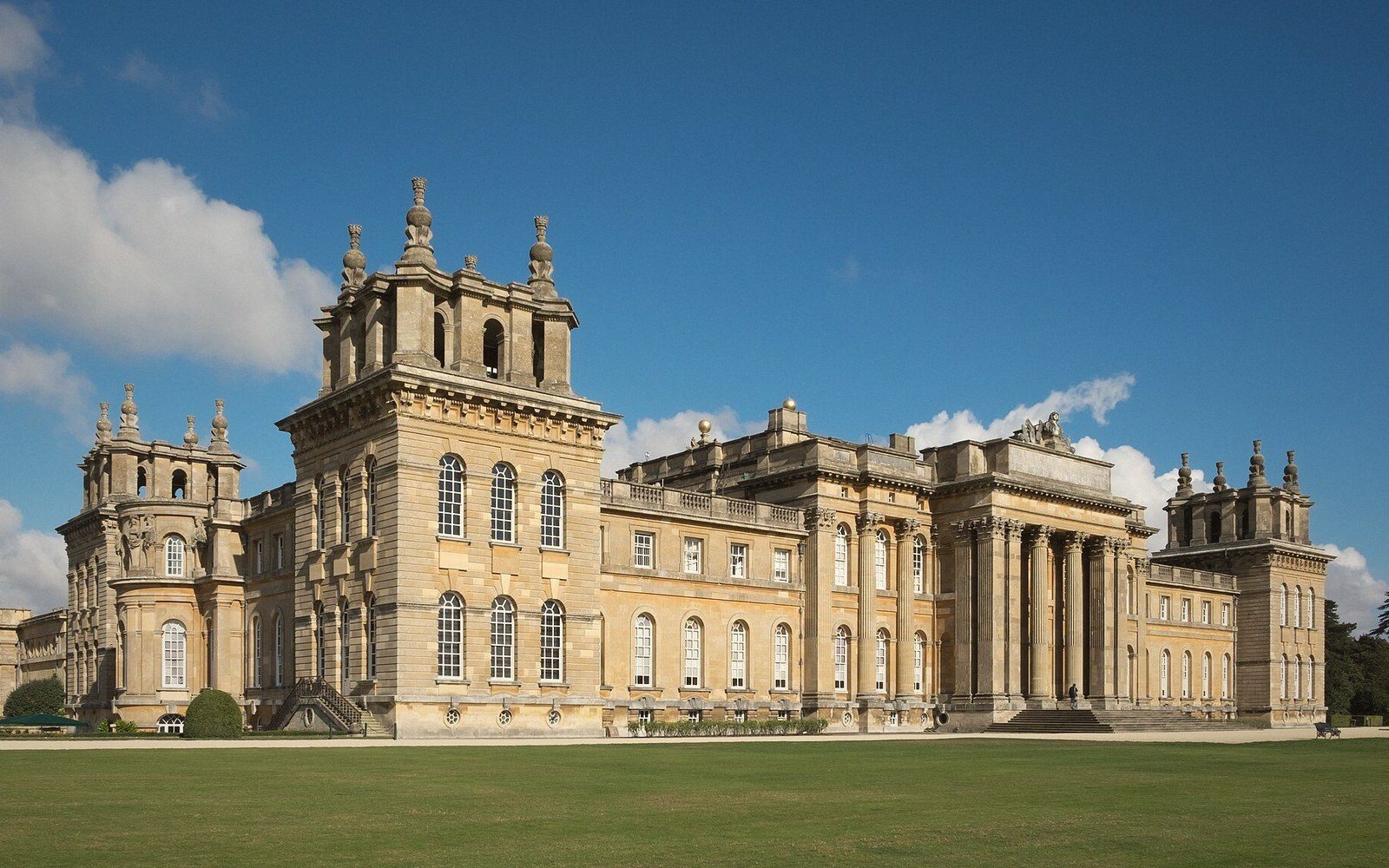
A hunting ground older than the palace by several centuries
The palace dominates the eye so completely that it is easy to assume the park existed to set it off. The logic runs the other way. Blenheim's landscape is a royal hunting ground that was already ancient when the first stone of Vanbrugh's building was laid in 1705, and the eighteenth-century designers who remade it — Vanbrugh and Wise first, then Capability Brown — were working inside a boundary that had been drawn and maintained for something close to six hundred years before they arrived.
The manor of Woodstock was in royal hands by the early twelfth century, and the deer park was enclosed not long after. Henry I, who held the manor and used it as a lodge from which to hunt, is traditionally credited with enclosing the ground — a park in the medieval sense being a legally defined, walled or paled enclosure within which deer were kept as a royal resource. The enclosure was substantial: the medieval pale ran for several miles, and the park it contained was large enough to be treated as a separate administrative unit from the town of Woodstock that grew up against its boundary wall. The town and the park existed in deliberate adjacency, the settlement supplying services and receiving custom, the park remaining firmly closed.
What the medieval park contained was not the rolling, tree-dotted grassland that visitors see today. It was managed hunting country: areas of dense woodland called haye or hay, designed to drive deer toward waiting hunters; open launds where the animals grazed; and the practical infrastructure of a working royal estate. The spring called Rosamund's Well, later mythologised into the legend of Fair Rosamund, was a real water source within the park, and Henry II is associated with the manor in the second half of the twelfth century. The romantic accretions — the bower, the labyrinth, the jealous queen — are medieval storytelling layered onto a functional landscape of lodges, deer and managed woodland.
The park through the medieval centuries
The park survived changes of dynasty because its value was understood as a resource, not merely as sentiment. Successive monarchs used Woodstock as a hunting lodge; the manor house within the park was rebuilt and extended across the centuries, most substantially in the medieval period, and Edward the Black Prince was born there in 1330. The park itself received periodic attention — its pale repaired, its deer stocks managed — because a decayed park was simply an asset lost.
By the Tudor period the manor of Woodstock was a working royal property, occasionally used as a place of detention as well as a hunting base: the future Elizabeth I was held at the manor house for a period during the reign of her half-sister Mary. The landscape of the park in this period was still primarily functional, still organised around the management of deer and timber, still bounded by the same long pale. The ornamental consciousness that would eventually produce Brown's lake and the Grand Bridge was not yet present; the park was a larder and a hunting ground, and it looked like one.
James I hunted here. The medieval manor house, never a building of architectural distinction, was in serviceable rather than palatial condition by the early seventeenth century. Across the Stuart period the park continued to function, but the political turbulences of the century took their toll on royal estates generally, and Woodstock was not exempt. The Civil War brought a royalist garrison into the manor, which Parliament besieged and took in 1646; the manor house was slighted, its remains falling into increasing ruin across the later seventeenth century. By the time the Marlborough grant was made, the old manor was a heap of rubble and dressed stone within a landscape that retained its medieval boundary and its deer but had lost its residential core.
The medieval manor house, never a building of architectural distinction, was in serviceable rather than palatial condition by the early seventeenth century.
- c. early 12th centuryHenry I encloses the deer park at Woodstock
- 1330Edward the Black Prince born at Woodstock manor
- c. 1554–55Princess Elizabeth held at Woodstock manor during Mary I's reign
- 1704Battle of Blenheim (Blindheim), Bavaria; Marlborough's victory
- 1705Royal manor granted to John Churchill, first Duke of Marlborough
- 1708–10Grand Bridge designed and built by Vanbrugh
- 1760sCapability Brown dams the Glyme; the ornamental lake created
What the eighteenth century inherited
The Blenheim grant of 1705 — the gift of the royal manor to John Churchill, first Duke of Marlborough, in recognition of the victory at Blenheim on the Danube the previous year — transferred not a blank site but an already complex landscape. The medieval park boundary was intact. The river Glyme ran through the valley at the park's centre, shallow and unremarkable in itself. Woodstock town sat against the northern wall. The ruins of the old manor were visible. Ancient woodland stood in several parts of the park. And the whole enclosure had a character shaped by centuries of management as hunting country: it was open where it needed to be open for the chase, wooded where cover was required.
Vanbrugh, appointed architect of the new palace, understood immediately that the existing landscape had value. His instinct — frustrated by the Duchess Sarah, who found his grandiose schemes maddening and wasteful — was to incorporate the old ruins of the manor as a picturesque element in the new composition. He was overruled, and the ruins were eventually cleared. But his other instinct, that the valley of the Glyme demanded a bridge of theatrical scale, produced the Grand Bridge, designed before anyone had decided what the water beneath it would look like. The bridge was built between 1708 and 1710, massive and magnificent, spanning a stream that was nowhere near wide enough to justify it. The bridge was built for the landscape it would eventually inhabit, not the one it stood in.
That landscape came later, and it came from the Glyme. Brown made the lake do the work when he reshaped the valley in the 1760s: damming the river, flooding the low ground, raising the water level until the Grand Bridge stood, at last, over something proportionate. The great serpentine lake that defines the view from the palace's south front is an engineered lake on medieval ground, the Glyme transformed by an earthen dam into a feature that appeared, when Brown had finished with it, to have been natural all along.
The park's medieval deer did not vanish. Blenheim still carries a herd of fallow deer, and the walled boundary — much of it following the line of the old pale — remains. The landscape that tourists enter through the triumphal archway at Woodstock, or through the Hensington Gate on the other side, is continuous with the landscape Henry I enclosed. The palace sits within it, grand and undeniable, but it sits within it: the guest inside an enclosure that was already organised, already maintained, already understood as a valuable and definite place before the architects arrived.
The medieval park is the structural fact beneath all the eighteenth-century beauty. The long wooded perimeter, the ancient trees that punctuate the open ground, the deer themselves — these are not decorative choices made by Brown or Vanbrugh. They are what was already there. The genius of the Georgian remaking was partly to recognise this, to work with the scale that six hundred years of management had established, and to fold the old hunting ground into a designed landscape without destroying what made it worth inheriting in the first place.
An independent guide to North Oxfordshire. Not a tourist board, booking service or official body, and not affiliated with any property or business described.